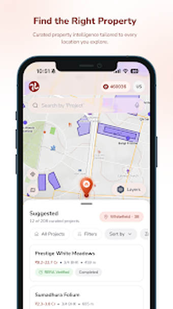
Map-first spatial intelligence for parcel-level property decisions
Layers parcel boundaries, zoning, upcoming transit projects, and 3D visualizations to let users evaluate a land parcel's risks and growth potential in minutes. TalkingLands, from TalkingLands Tech, runs on Android as a utilities tool for property research. The app pairs AI-powered spatial summaries with 150+ map layers and automated due-diligence overlays. First-time buyers, investors, and real-estate professionals in major Indian markets benefit from parcel-level clarity and faster decision cycles.
What does TalkingLands actually do?
TalkingLands assembles location data onto an interactive map and generates AI summaries that reduce manual checks. The app displays legal boundaries, zoning, infrastructure plans, and environmental risk layers, and it offers 3D property visualization. These capabilities compress the evaluation timeline from weeks to minutes by overlaying revenue records, municipal regulations, and transit project proximity on a single interface.
Does it slow down your device during map analysis?
High-resolution maps and AI processing run on modern smartphones, which the developer optimised for Android devices. Because the platform renders 3D views and 150+ layers, expect higher CPU and GPU use on older hardware; the source notes optimisation for modern phones to support smooth rendering and on-device AI features.
Is it safe to use for due diligence and risk checks?
Safety follows from data consolidation and AI flagging: the app flags proximity to protected zones, water bodies, and government-notified land as risk indicators. It integrates municipal and revenue records into the same view so users can compare legal notes against mapped boundaries before progressing with acquisition steps.
Do I need technical knowledge to operate TalkingLands?
It targets both individual buyers and enterprise teams, but levels of use differ. A first-time buyer can read the AI-generated parcel summary, while developers and land-bank managers can combine multiple layers and track connectivity changes. The app’s map-first workflow reduces menu depth, though advanced layer selection and legal interpretation benefit from domain familiarity.
Who should use TalkingLands and why
TalkingLands suits users who need parcel-level clarity in major Indian markets, especially teams that manage land portfolios or perform rapid due diligence. Its combination of AI summaries and layered municipal data reduces manual cross-checks, while its focus on modern Android devices limits performance on older phones. Recommended.